

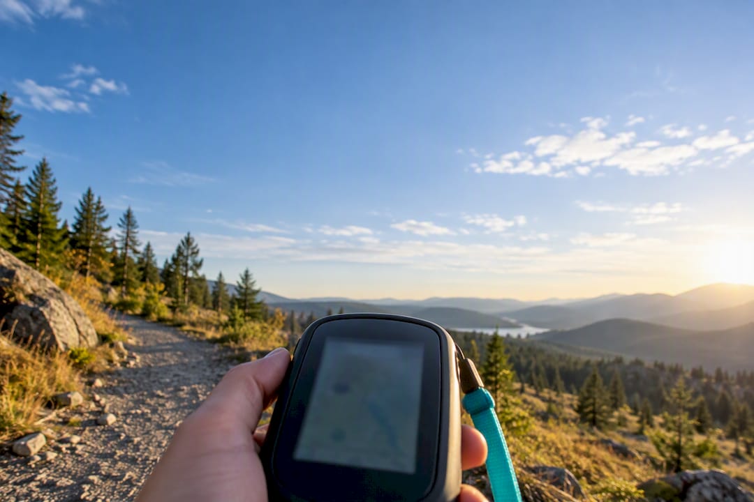
Under open sky, your phone’s GPS is typically accurate to within about 5 meters, and a good handheld receiver can do slightly better. That number is a starting point, not a guarantee. Trees, buildings, canyon walls, and a cheap antenna can push the real error far past what your screen’s blue dot implies, so treat every fix as an estimate with a radius, not a pin on a map.
TL;DR:
- GPS accuracy can be significantly affected by terrain, atmospheric conditions, and device quality, often resulting in errors exceeding 5 meters outdoors.
- Multi-constellation receivers combining GPS with GLONASS, Galileo, and BeiDou generally improve fix reliability and can approach meter-level precision in open environments.
- Conditions like signal blockage, multipath reflections, and poor satellite geometry (PDOP) can cause positional jumps, drift, or inaccuracies in tracking routes.
- Smartphone GPS typically provides around 5-meter accuracy, while dedicated handhelds can achieve about 3 meters in ideal conditions, mainly due to better antennas and processing.
- Using correction services such as RTK or differential GPS can attain centimeter-level accuracy, but these require specialized hardware and are unnecessary for most practical outdoor navigation.
Table of Contents
- How GPS Actually Figures Out Where You Are Outdoors
- What Determines GPS Accuracy Outdoors
- How Accurate Is GPS by Device Type?
- Why Your Tracked Route Looks Longer Than It Should
- How to Improve Phone GPS Accuracy Outdoors
- How Well-Check Uses GPS Responsibly for Safety Monitoring
- When Is “Good Enough” GPS Actually Good Enough?
- Where to Read the Original GPS Standards
- Sources
- FAQ
How GPS Actually Figures Out Where You Are Outdoors
Every GPS satellite broadcasts its exact position and a precise time signal. Your receiver picks up signals from several satellites at once, measures how long each one took to arrive, and converts that delay into a distance. Cross four or more of those distances and the receiver can solve for your location through a process called trilateration.
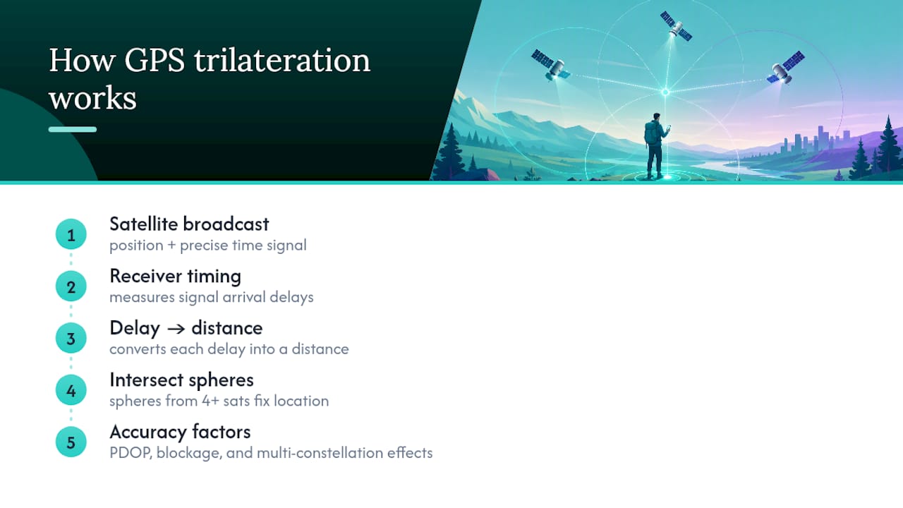
The math is only as good as its inputs. Two devices standing side by side can report different accuracy because satellite geometry, or PDOP, changes how much error gets amplified in the calculation. Satellites spread widely across the sky give a tighter fix than a cluster bunched near the horizon. GPS.gov is blunt about this distinction: the accuracy of the broadcast signal itself is not the same thing as the accuracy you actually experience on the ground, since local blockage, atmospheric conditions, and receiver quality all take their cut.
Most modern phones and handhelds no longer rely on GPS alone. They also pull signals from GLONASS, Galileo, and BeiDou, three other global satellite networks, which puts more satellites in view at any given moment and generally tightens the fix. That multi constellation approach is a big part of why outdoor GPS accuracy has quietly improved over the past decade without most people noticing.
What Determines GPS Accuracy Outdoors
Six factors decide whether your device nails your location or leaves you standing 15 meters from where the map says you are.
- Satellite geometry (PDOP): More satellites spread across a wide arc of sky produce a tighter, more reliable fix than a handful clustered together.
- Signal blockage: Buildings, bridges, cliff faces, and dense tree canopy block or delay the direct line of sight a receiver needs.
- Multipath reflections: Signals bouncing off glass, rock, or water arrive slightly later than the direct signal, and the receiver has to guess which one to trust. Vegetation scatters signals in a similar way, and this kind of error tends to hit slow movers like hikers harder than someone driving through the same spot, according to ESA’s research on satnav performance in forests.
- Atmospheric delay: The ionosphere and troposphere bend and slow signals unpredictably. Dual-frequency receivers measure two signal bands and cancel out most of this error, though it’s only one piece of the puzzle.
- Receiver and antenna quality: Cheap chipsets, poor filtering, and low update rates all add noise a premium receiver would smooth out.
- Augmentation and correction: Differential GPS, Real-Time Kinematic (RTK), and Precise Point Positioning (PPP) systems layer correction data on top of raw signals, and they’re the only realistic path to sub-meter precision.
The worst outdoor conditions combine several of these at once. Standing at the base of a rock face under tree cover gives you blockage and multipath in the same spot, which is exactly the kind of mixed terrain that produces the largest position errors hikers encounter.
How Accurate Is GPS by Device Type?
Accuracy expectations shift dramatically depending on what’s in your hand or strapped to your pack. Here’s what each category realistically delivers under open sky.
- Smartphones: Roughly 5 meters of horizontal accuracy under open sky, per GPS.gov’s published accuracy standard. That figure is an uncertainty radius, meaning your true position could be anywhere inside a circle that size, not a fixed offset in one direction.
- Outdoor handheld receivers: Dedicated units built for hiking or field work often land around 3 meters, 95 percent of the time in favorable conditions, based on the government’s SPS Performance Standard for well-designed receivers. The better antenna and dedicated GPS chipset explain most of the gap over phones.
- Standalone trackers and vehicle units: Similar baseline accuracy to handhelds, but real-world performance depends heavily on antenna placement and how often the unit checks in. A tracker mounted low on a pack or dashboard, updating once a minute, will drift more than one with a clear sky view updating every few seconds, as described by the Kin One · Kin Watchdog device approach.
- Survey-grade and RTK equipment: With correction services and dual-frequency hardware, real-time positioning can reach a few centimeters, and specialized long-term measurements can approach millimeter levels, per GPS.gov. That level of precision requires dedicated hardware and, usually, a subscription correction service. It is not something a consumer app can deliver.
If you’re comparing the best GPS devices for hiking, the honest answer is that a $150 handheld and a flagship phone will often land within a meter or two of each other in open terrain. The real gap shows up under tree cover, where the handheld’s better antenna starts to earn its price.
Why Your Tracked Route Looks Longer Than It Should
A GPS track that shows you wandering in circles while you stood still isn’t a glitch. It’s the signature of a specific, identifiable problem.
- Stationary drift. Random signal noise causes the reported position to jitter even when you haven’t moved, and depending on how the device filters that noise, a five-minute break can add fake distance to your total.
- Sudden jumps. A position that leaps 50 meters in one update and back the next usually points to multipath interference or a brief loss of satellite lock, often from stepping under thick canopy or between buildings.
- Stale fixes from power saving. Battery-saver modes and low update-rate settings mean the device only checks position occasionally, so a fast-moving jump on the map might just be two real points connected by a long, straight guess.
- Misread accuracy circles. Every fix comes with a reported accuracy radius and a timestamp, and GPS.gov’s own guidance is to judge a route by the latest position, its uncertainty, and its timestamp rather than treating every breadcrumb as exact.
Before assuming your device is broken, check the timestamp and accuracy value on the questionable point. Nine times out of ten, a wide accuracy radius or an old timestamp explains the weird jump.
How to Improve Phone GPS Accuracy Outdoors
You can meaningfully tighten your fix without buying new hardware, and a few habits make a bigger difference than most people expect.
- Turn on high accuracy location settings. Most phones offer a mode that combines GPS with Wi-Fi and mobile network data. Google specifically recommends enabling Location Accuracy and keeping Wi-Fi or mobile data on even outdoors, since it helps the device lock on faster.
- Move to open sky. Stepping 10 or 15 feet away from a rock wall or out from under a tree canopy can improve a fix within seconds. This is usually the single fastest fix available to you.
- Calibrate the compass, but know its limits. A compass calibration fixes heading (which direction you’re facing), not the underlying satellite position calculation. If your dot is in the wrong spot, recalibrating the compass won’t move it.
- Turn off aggressive battery saving during active tracking. Power-saving modes throttle how often your phone checks position, which is fine for casual use but a problem when you need frequent, current fixes.
- Choose multi-constellation, dual-frequency gear for consistency. If meter-level precision matters for your work, this hardware upgrade matters more than any setting change.
- Bring in augmentation for real precision needs. DGPS or RTK correction services are the only realistic way to hit centimeter accuracy, and they require dedicated equipment or a professional survey service.
Pro Tip: If you’re using GPS for anyone’s safety, not just your own convenience, always show the reported accuracy radius on screen and require a manual confirmation step when that accuracy is poor. A stale or fuzzy fix should never be presented as a confident location.
How Well-Check Uses GPS Responsibly for Safety Monitoring
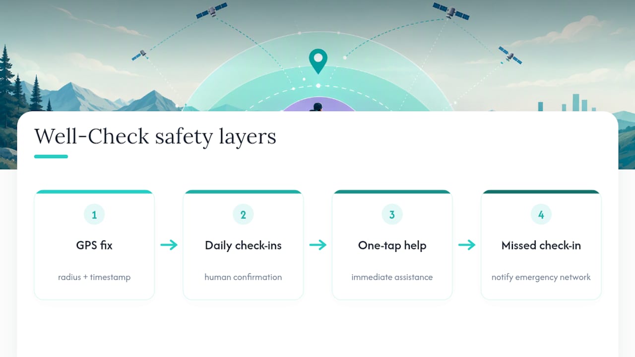
A single GPS point is a data point, not proof of safety. That’s why location should always carry its accuracy radius and timestamp alongside it, so anyone reading the fix understands its real confidence level rather than mistaking a rough estimate for an exact address.
Well-Check builds around that principle by pairing GPS tracking with daily check-ins, one-tap help, and caregiver alerts, so families aren’t relying on a single coordinate to know someone is okay. If a check-in is missed, the app notifies the emergency contact network directly rather than leaning solely on a location ping. That layered approach, disclosing accuracy limits, prompting confirmation when a signal looks uncertain, and combining GPS with human check-ins, reflects how location data should function in any safety context, not just navigation. You can see how these pieces fit together on the Well-Check product page.
When Is “Good Enough” GPS Actually Good Enough?
For everyday navigation and most safety monitoring, meter-scale accuracy paired with a visible uncertainty radius covers the job. You don’t need survey-grade hardware to know someone is near home versus three blocks away.
Escalate to dual-frequency or RTK-corrected equipment only when the task demands centimeters, like staking a property line or placing infrastructure. Outside those narrow cases, the smarter investment is in the workflow, not the hardware: build interfaces that show confidence honestly instead of implying a false precision the underlying signal never promised.
— Brian
Where to Read the Original GPS Standards
Ready to add a safety net that doesn’t rely on GPS alone? Well-Check’s Essential and Complete plans start at $5.99 a month and combine location tracking with daily check-ins and caregiver alerts, so one weak signal never becomes the whole story.
Sources
- Gps
- Seeing the satnav for the trees | ESA
- Global Positioning System (GPS) Standard Positioning Service (SPS) Performance Standard – 5th Edition, April 2020
- Improve location accuracy | Google Maps Help
- GAO-24-106841: GPS modernization: delays continue in delivering more secure capability for the warfighter
FAQ
How Accurate Is Military-Grade GPS?
Military GPS uses M-code signals designed primarily for resistance to jamming and spoofing, not dramatically higher raw positioning accuracy for everyday use. The GAO’s modernization report confirms this upgrade focuses on signal resilience for defense applications, and it doesn’t automatically translate into better accuracy for civilian devices.
What Is the Most Accurate Type of GPS Available?
Dual-frequency receivers using RTK or PPP correction services deliver the highest accuracy, reaching real-time positioning within a few centimeters and, in specialized long-term setups, millimeter levels according to GPS.gov. That level of precision requires dedicated survey-grade hardware and a correction subscription, not something built into a standard phone or handheld.
What Does Russia Use Instead of GPS?
Russia operates its own satellite navigation system called GLONASS, which functions independently of the US-run GPS network. Many modern phones and receivers already combine GLONASS signals with GPS, Galileo, and BeiDou to improve satellite availability and fix quality.
What Is the Typical Accuracy of Consumer GPS?
Under open sky, a typical GPS-enabled smartphone is accurate to within about 5 meters, per GPS.gov, while dedicated outdoor handhelds often achieve around 3 meters, 95 percent of the time in favorable conditions under the SPS Performance Standard. Both figures represent an uncertainty radius that worsens near buildings, bridges, and tree cover.